Optimizing on-demand services – A complementary station-based and shared on-demand micro-transit service Glyfada wants to strengthen its public transport network with flexible, demand-driven mobility services. The idea is that the different services will work together and not compete. To this end, the city will lean on concepts and algorithms developed in DIT4TraM for passenger flow management, fleet management, and optimal vehicle allocation. The city is also deploying tradable mobility permits

Glyfada is a suburb at the south of Athens, Greece that is a very popular destination for tourists, as well as for locals, due to the beautiful sea view (Glyfada is part of the so-called Athens riviera) and the numerous restaurants and cafes. The municipality of Glyfada also includes an extensive residential area (population about 90000) which, however, is not served by a sufficient public transport network, forcing citizens to use their private vehicles, while the nearest metro station is at a neighboring municipality (Elliniko). As a result, the city center of Glyfada gets very crowded, especially during peak hours, which, in combination with the low public transport coverage, make traffic conditions unsustainable.

Pilot Objectives
The objective of the pilot is to examine the joint operation of the existing transit system and a novel on-demand service, in terms of user acceptance and impact on the road network’s efficiency, with the aim to enhance public transport usage by connecting the city center with the residential areas. The service will use a fixed number of stations for embarking and disembarking, which will be aligned with the existing public transport services. Moreover, the vehicles will visit the stations in an optimal way (no fixed route), based on the passengers’ destinations and the demand at each station. A novel algorithm is developed for both matching the passengers with the vehicles and routing in real time, based on the incoming requests and navigating the vehicles from one station to another. Finally, a dedicated smartphone application will be developed for the interface between the system, the drivers and the potential users. The main specifications are described in the table below.
| Main Objective | Reduce congestion and private vehicle usage, connect residential areas with city center |
| Location of stations | Close to POIs (residential areas, business/commercial areas, public transport stations) |
| Fleet size | 8-10 vehicles |
| Vehicle type | 6-seat vans |
| Routing | Fixed location of station, optimal visiting order based on demand |
| Fee | Free of charge during pilot (exploitation strategy after pilot) |
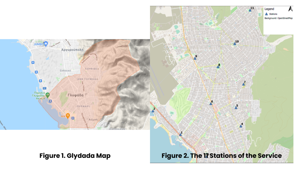
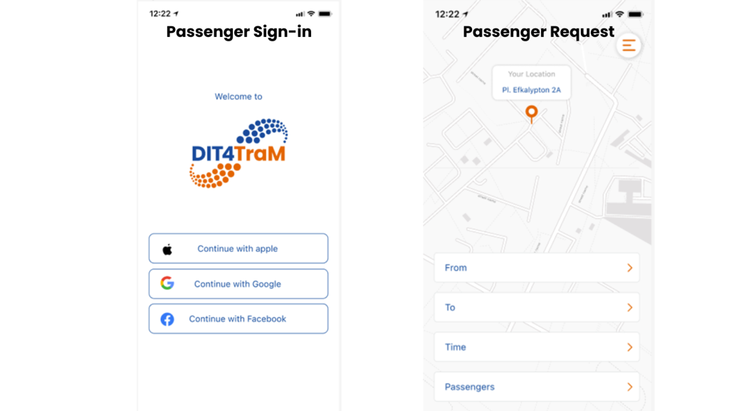
So far, we have developed the routing algorithm that matches passenger requests with vehicles and conducted some simulation experiments that validate its efficiency. Also, we have developed two dedicated smart apps, for the interface between the system, the drivers and the users (screenshots provided below). In addition, we have defined an optimal set of locations for 11 stations (based on land use and demand data), which are close to residential areas, crowded business/commercial areas and public transport stations (map provided below) and, finally, we have collected and analyzed travel time data between the stations, which will be used for defining the optimal visiting order.
As of now, we haven’t produced any publications or other outputs. The only available document is D7.1, which outlines some initial specifications.
